60th LOUTH RACES – A BUCKET LIST ADVENTURE
While on a weekend camping trip knocking back a few frothies by the fire with the boys.
It was decided a trip to Louth for the 60th running of the Louth Turf Clubs annual races was needed.
As a result, the morning after the night before with foggy heads…The trusty HEMA road book was sourced and a route was to be planned.
WE ARE OFF
After a quick load up on Wednesday morning we left Coffs Harbour just before lunch.
It took a bit of back road to meet up with the Gwydir Highway and head west out of Grafton.
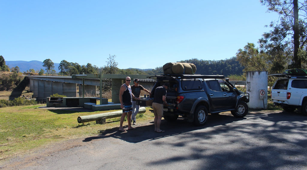
A scenic drive in its own right, we made it to Jackadgery where we would cross the Mann River after a quick bite and an ice-cold lemon squash.
From the picnic area you can see the remains of the old bridge upstream.
This was replaced when the new bridge was opened on the 7th October 1961 for a flood free route.
THE CELTIC TOWN OF INVERELL
A short haul up the road and you meander into the Celtic town of Inverell.
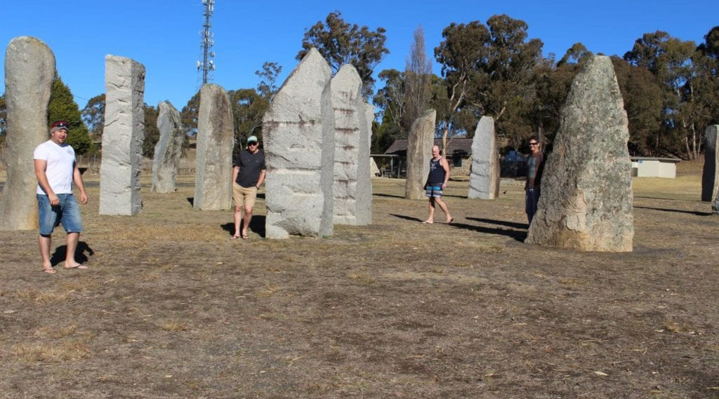
Then a quick left hooker we headed up to the Standing Stones and went for a wander.
About 40 minutes out of Inverell is the picturesque Copeton Dam.
While not being high season we felt like we had the 4600ha of it all to ourselves.
With dam levels at 24% when we visited, camping waterside meant a bit more of a wheel to find the perfect spot.
About 40 minutes out of Inverell is the picturesque Copeton Dam.
While not being high season we felt like we had the 4600ha of it all to ourselves!
With dam levels at 24%, camping waterside meant a bit more of a wheel to find the perfect spot.
POO WITH A VIEW
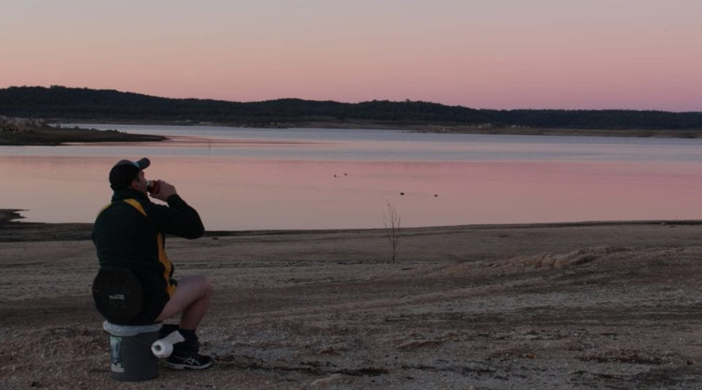
With camp set up in a few minutes, Chriso took a ‘Poo with a View’ and I called ‘shotgun’ in the Triton for tomorrow
So Chriso had to drive first on day 2.
That night some of us hit it harder than a head into a brick wall (possibly me).
In the morning I came to the conclusion that ¾ of my fresh Jameson bottle had leaked from the bottle and into my mouth.
I don’t remember getting into my swag, rumour has it Downsy had to put me in it.
Luckily he didn’t leave me asleep in the camp chair by the fire!
With sore heads and a -3°C morning temp, a quick feed was cooked up followed by hot showers on the way out.
A quick Pie from the Bingara Bakery and we had our sights set on Gundabooka National Park just west of Bourke.
Leaving Bingara this took us through Killarney Gap, Narrabri, Wee Wah, Burren Junction, Artesian Bore baths (which we called into on our way back).
Then Bourke for a top up of the tanks and then some red dirt camping at Dry Tank Camp in the National Park.
The campgrounds have many flat camping areas with good facilities.
Easy to fit in a few utes, swags and camper trailers.
With the fire cranking, bovine cooking on the BBQ and a few cups filled with distilled goodness, race day was approaching fast.
MULGOWAN ABORIGINAL HERITAGE SITE
On leaving Dry Tank Camp in the morning we backtracked about 20 kms towards Bourke.
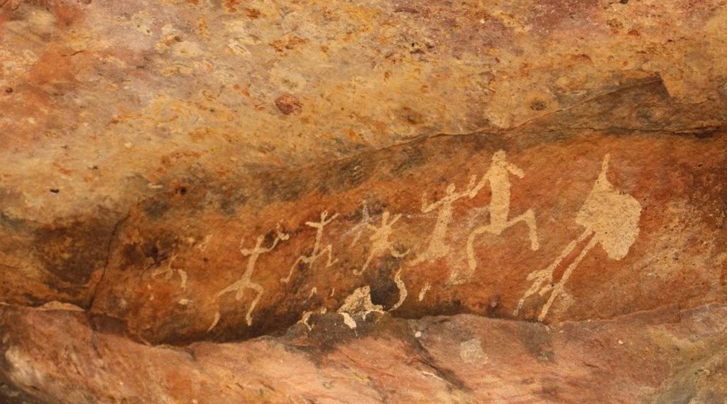
This was a special trip to see our first awesome Aboriginal rock art at the Mulgowan Aboriginal Heritage site.
The Yapa Rock Art site is only a short walk from the carpark on a very well-defined track.
We were blown away by what we saw.
I’m sure there are more sites in the area that would be great to explore and admire.
ONTO LOUTH
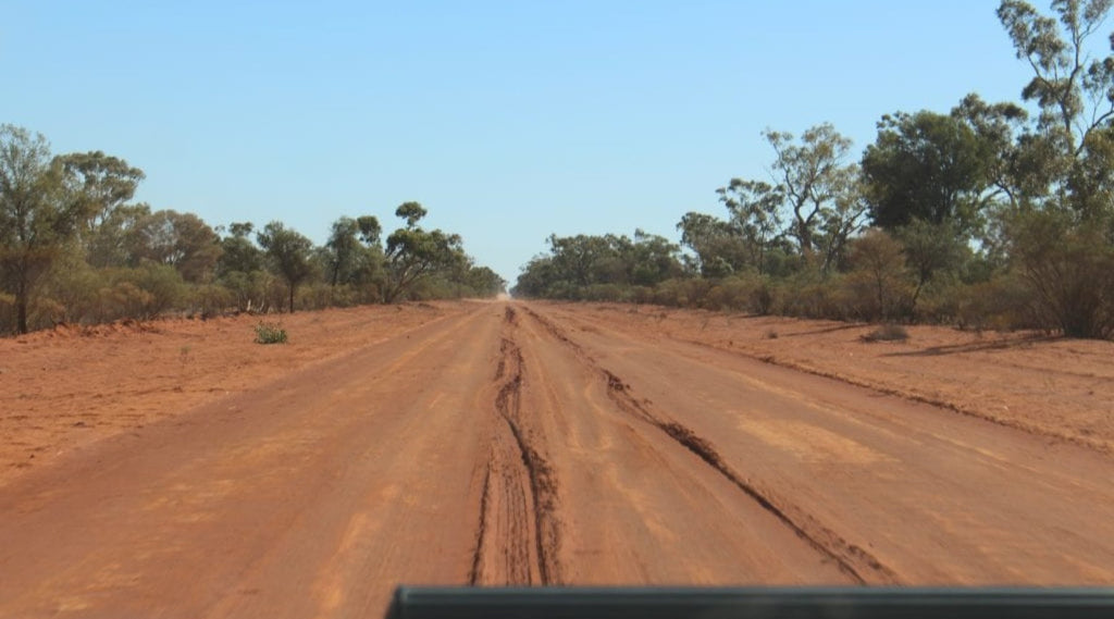
Only about 60 kms from where we were, we saw evidence that after any amount of rain out here, the journey could go from an hour to a whole day.
Why? Because of the squiggly 4×4 tracks in the crown of the dry and dusty road and about 3-4 inches deep.
They showed someone's struggles to keep it out of the swale drains and the boggy mess.
This re-enforces why I only run Muddies on my ute because you never know what may happen or what's up ahead.
WITH LIVE MUSIC PUMPING
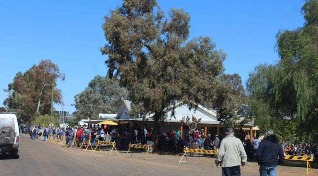
Rolling into the Port of Louth on the near empty Darling River.
It was time to go find a camp spot on the river bank and then head up to Shindy’s Inn for a few amber ales.
With live music pumping, the crowd continued to swell and beer flowed faster than King George Falls in the wet!
The Shindy Hotel was on target to get 70% of their yearly income in these two days trading!
Because during the race weekend, the town of Louth multiplies from its regular population of about 43 to over 4000!
RACE DAY
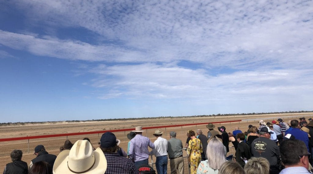
Waking up on Race Day we were dustier than the dry river banks.
Therefore, it was off to the necessary hot showers with a gold coin donation and get ready for the punt.
One tip for newcomers, it’s not like Birdsville Races where pub tickets are accepted at the racetrack.
Here the Turf Club only takes cash.
After a few wins and losses on the punt, the Race day was ending and with that. the after party began.
Not as messy as after the Melbourne Cup though.
However the party began back at Shindy’s Inn and then along the banks of the Darling River till early in the morning.
THE RETURN TRIP
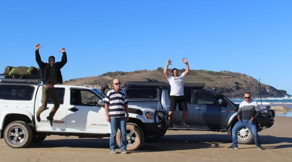
Our return trip back to Coffs Harbour would see us travelling to even more remote and less travelled routes.
We journeyed through some spectacular country which I estimate we did on 70% dirt roads.
What a great weekend!
HISTORY AND FACTS
Standing Stones – The first stone was raised on September 7, 1991. Officially opened by NSW Governor on February 1st 1992.
Copeton Dam – Covers 46km², has a wall length of 1.48km, Capacity is about 3 time that of Sydney Harbour and construction began in 1968 and completed in 1973. Copeton Reflections Holiday Park
Gundabooka National Park – 63,900ha, First noted by Charles Sturt in 1829. Wasn’t pastoralized until the late 1800’s.
Has Aboriginal Rock Art sites highly significant to the Ngemba and Kurnu Baakandji people of western New South Wales, Old homesteads and Shearers quarters.
Louth – Established as a Port in 1859 when Thomas A Mathews built a pub ‘The Daniel O’Connell Hotel’ to cater for the passing River trade.
Known for its Racing Carnival and the Shining Headstone of T.A Matthews wife.
Louth Races – Village Races date back to 1880 where the first Christmas race was held on the 27th December that year.
The second race was held in 1889 and was a 2-day event – Day 1 a 2-mile hurdle event then a 5-race program. Day 2 had an 8-race program.

COORDINATES OF MENTIONED LOCATIONS
Jackadgery – Mann River – Lat -29.5771, Lon 152.5549
Standing Stones – Lat –29.7413, Lon 151.7519
Copeton Dam – Lat -29.9051, Lon 150.9242
Kilarney Gap – Lat -30.1323, Lon 150.0804
Artesian Bore Baths – Lat -30.1142, Lon 148.9956
Dry Tank Campgrounds – Lat -30.5180, Lon 145.7146
Mulgowan Aboriginal Heritage site – Lat -30.6404, Lon 145.7680
Shindys Inn – Louth – Lat -30.535080, Lon 145.115459
Ebor Falls – Lat -30.4024, Lon 152.3438
Boambee Beach Coffs Harbour – Lat -30.3130, Lon 153.1404
Words and Images by Jereme Lindsell of Trickydevil Offroad
WHERE TO FIND JEREME
Instagram: @trickydevil_offroad
Youtube: Trickydevil Offroad
Facebook: Trickydevil Offroad
