
THE QUICK WEEKEND GETAWAY
It all started with a message from Tommo and Matt on hump day saying ‘let’s head off Friday arvo to Copeton’ with a few detours on the way.
How could any warm-blooded person refuse such an offer?
Well my kids did, so they missed out.
A quick shop Friday afternoon after finishing work and swapping Utes.
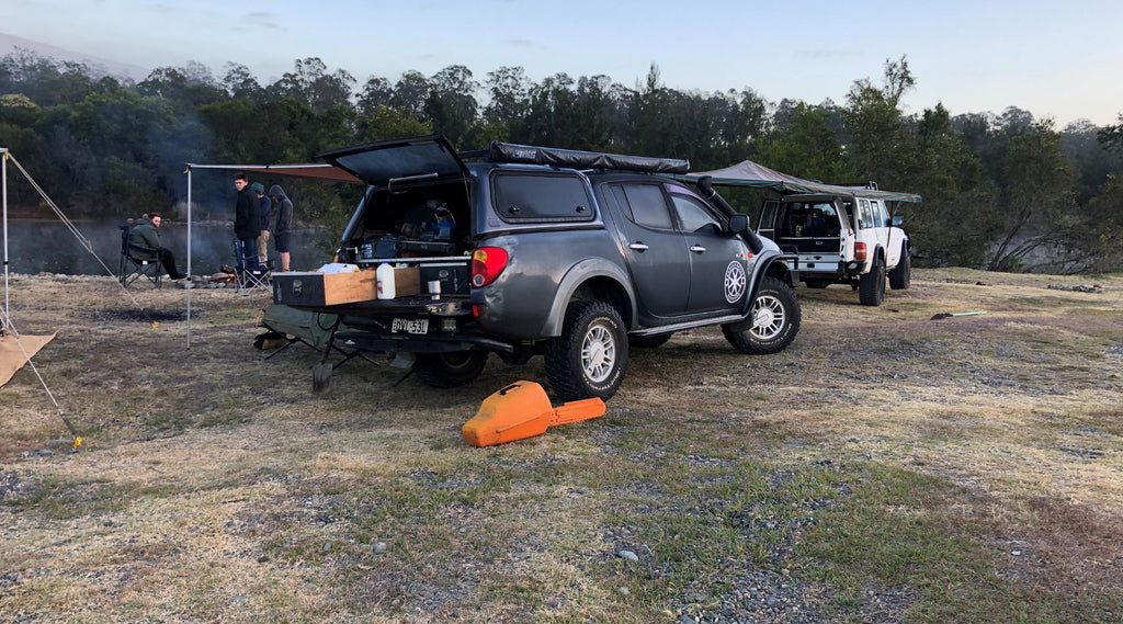
After that I headed out to meet up with Tommo before heading off for a Friday night by the campfire at Cangai.
FIRST STOP CANGAI
Getting there was a quick haul on the back road to Grafton, then a left hook onto the Gwydir out past Jackadgery.
Next was a right hook onto the dirt, down to Hanging Rock road and into Cangai.
With Matt finishing work earlier than the rest of us he had the campfire cracking when we got there.
So all we had to do was roll out the swag, grab a camp chair and a few frothies out of the esky.
Now, I thought, this is living!
You just can’t beat the bush telly while having a few yarns with old mates.
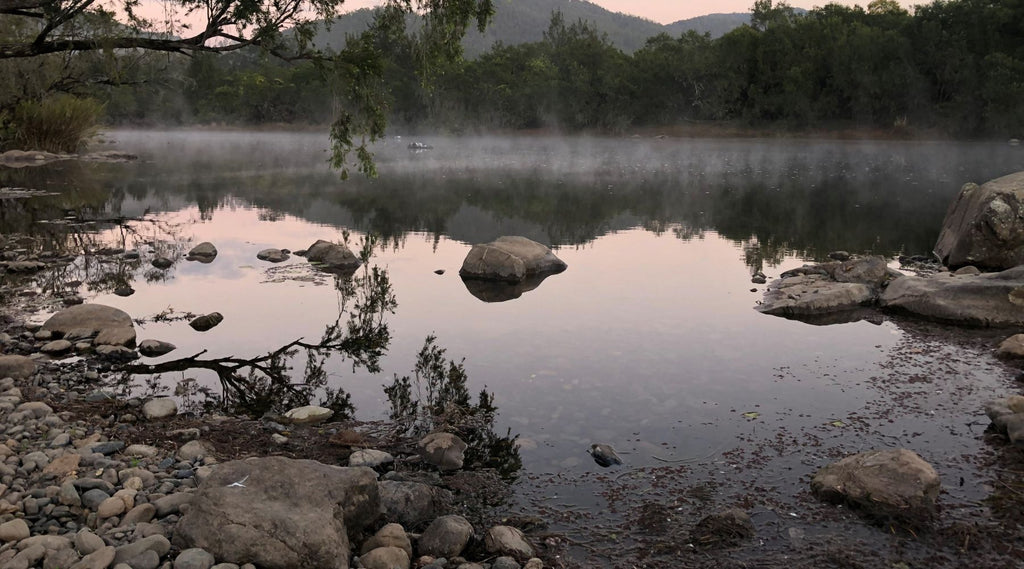
As Saturday dawned, it was time to rustle up a bit of grub and a brew.
After that we shook off the overnight dew and got back on the road to a mix of dirt and blacktop.
OAKY BLUFF CLIFFS
We headed back out through Hanging Rock Road.
From there we took a right hook onto the Gwydir for some decent elevation change.
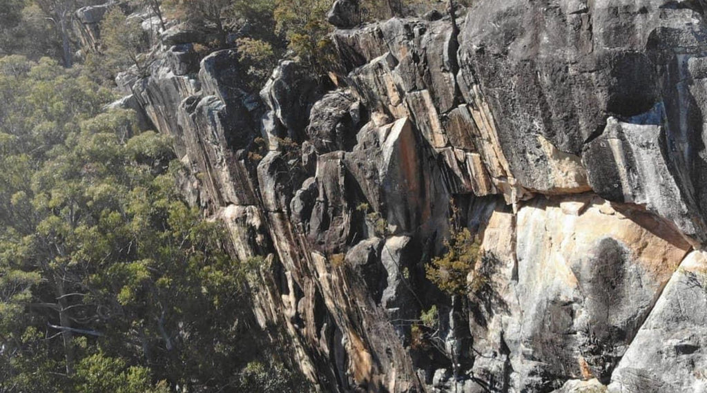
Heading up through the Gibraltar Range, Tommo had done some research on a few possible lookouts.
Two out of three were awesome!
You would never have known they were there unless you venture off the beaten track.
The two sweet lookouts were both no more than a 15 minute trip off the blacktop.
The first gem was Oaky Bluff Cliffs, with a great sheer face (pictured by Matt and his trusty drone), what a diamond in the rough.
From here it was a short hop down the road to the next hidden gem.
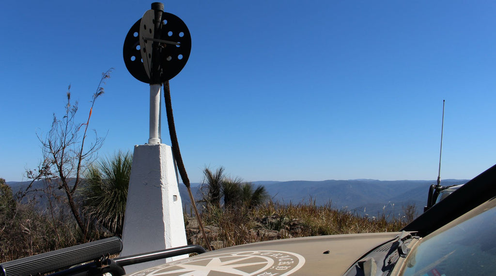
FOUR MILE TRIG
Four Mile Trig which is on Razorback Spur.
The original Trig (Trigonometrical Station) was a 100mm square timber post with metal circular vanes.
These were attached over a brass plug and set in the rock below.
Usually stabilised by a large rock cairn.
The new concrete pillar Trig station was established in 1979 with an elevation at 1107m AHD (Australian Height Datum) it’s getting up there in elevation.
I love getting to see different Trig Stations.
I’m a surveyor so sometimes in my job I get to go wheeling and doing GNSS (Global navigation satellite system) and GPS (Global Positioning System) Observations at Trig Stations.
A GREAT FREE CAMPING AREA
Once leaving Four Mile it was a quick hop down the blacktop towards Celtic country at Glen Innes.
Then past the big wind farms and onward to Inverell.
Heading south from Inverell we scooted through Gilgai
Hanging a right at Stanborough passing through Howell and into the Tingha Copeton Recreation Reserve.
A great free camping area with dam levels at a mere 8.9% capacity.
It was a completely different view to the last trip where I stayed in the Reflections paid camping site.
I think the dam levels were about 40% capacity then from memory.
Copeton Dam construction began in 1968 and was completed 1973 with a capacity of 863,000 megalitres.
In 1976 construction was completed on the nine radial gates in the spillway which increased the capacity to 1,364,000 megalitres.
Within the spillway is a 21 MegaWatt hydroelectric power station.
Two towns disappeared once the dam started to fill, Copeton and Dasey Town.
When the water level drops to about 4%, the remains of the old cemetery headstones can be seen.

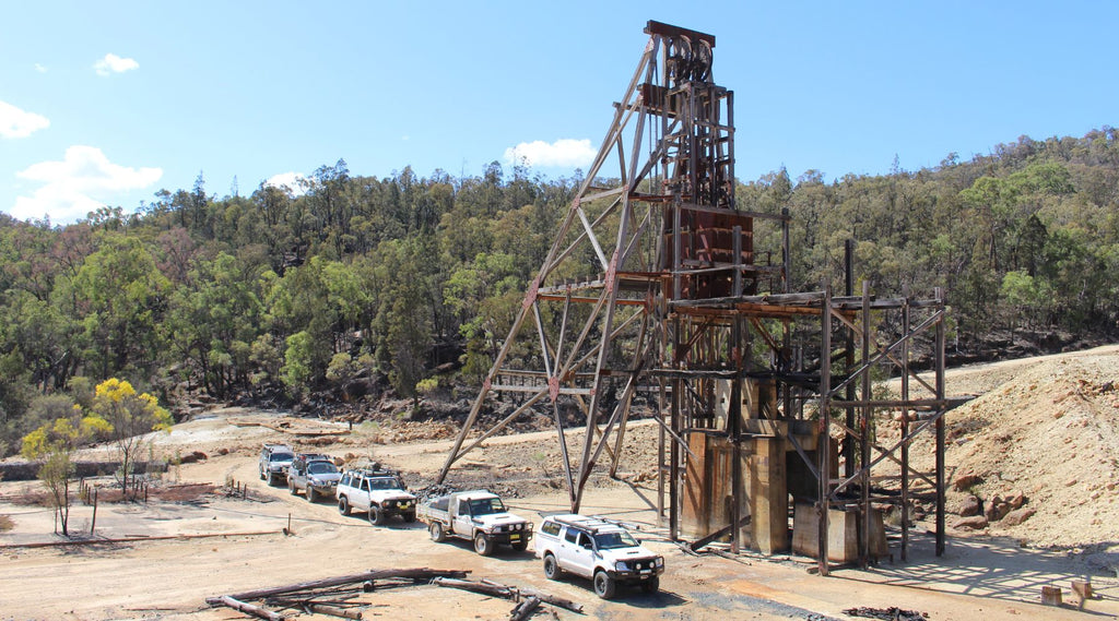
A WALK BACK IN TIME
Just a stone’s throw from where we camped is the remains of the Conrad Mine at Howell.
With plenty of infrastructure left on the site it’s a great look back in history.
It was a silver and base metal mine that operated between 1898 and 1957 under various names and operators.
Noted on the Resource and Geoscience NSW web page it is on the list of Derelict Mines
Program with ongoing rehabilitation works with the last works completed in 2017.
SILVER, LEAD, COPPER AND ARSENIC
The large timber structure is the Conrad Shaft and the large rock structure is the King Conrad Shaft.
We also saw the remains of the Moore drive in a gully off the right as we entered the site.
The deepest of the shafts is about 270 m below ground.
This has a yield of nearly 18,000 tonnes of concentrate consisting of silver, lead, copper and arsenic.
800 KMS CLOCKED UP
Once we had finished exploring it was time to hit the road again.
We grabbed a quick bite in Inverell and smashed the blacktop on the return trip to Coffs Harbour.
A fun filled weekend away with about 800 kms clocked up and well worth the effort.
For me it jogged up memories of previous places I had found out this way back in 2007 and 2013.
It has geared me up to show the crew something they never knew about and one place I never got back to explore properly.
If it is as good or better than what I’m hoping for it may just have to be kept secret…
While recording for Trickydevil Offroad YouTube channel a new phrase was captioned ‘viewgasm’ after hearing Tommo’s excitement when reaching Four Mile Trig.
Words by Jereme Lindsell and all images by Trickydevil Offroad and Matt Austin
LIVE COORDINATES OF MENTIONED LOCATIONS
Free camp spot – Lake Copeton – 29°54’51.8″S 150°59’31.2″E
Old Town – Howell – 29°54’32.8″S 151°01’49.1″E
Oaky Bluff – 29°32’30.4″S 152°13’43.3″E
WHERE TO FIND THEM
Instagram: @trickydevil_offroad
Instagram @coffscoast4x4andbushadventures
Facebook: Trickydevil Offroad
Facebook: Coffs Coast 4x4 And Bush Adventures
You can find other blogs by Jereme in our Adventure Travel section under blogs. Another popular blog is this one about a campsite at Bossberries Farm