OVER THE BLACK TOP
Time to head west and not take the usual black top route.
I had a quick review of the Hema 4×4 atlas and found an alternate new way.
The whole trip was from my home in Coffs Harbour to Narrabri.
There are a few different ways to go and I have driven the black top routes many times.
MIX IT UP
This time I decided to mix it up with some dirt road touring.
Heading from Coffs Harbour, up through Dorrigo, Ebor, Armidale then on my way to Tamworth I decided to stop in at Bendemeer.
Bendemeer is a small town that I’d passed right by many times before.
Originally Bendemeer was founded as McDonald River in 1835, but it was renamed in 1853.
Prior to this, the area was part of the Kamilaroi Aboriginal language group.
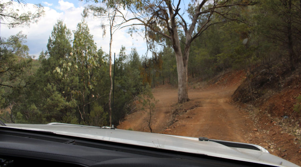
Once crossing the McDonald River, I headed out along Watsons Creek - Manilla Road, then onto Bungendore Spur Road.
NARROW DECENT
Not far along here the second main sign reads ‘narrow descent - not suitable for trucks and caravans’.
I thought this seems interesting, well it turns out that only about 5 km from here that it actually does get interesting!
The road is just wider than the Hilux, with steep drop offs on my passenger side.
I’m really hoping at this stage that I don’t meet any oncoming traffic.
Just a little further is the first 180° switch back with a bowl cut in to do a 3-point turn.
If you had a van it would definitely be a disconnecting process.
Less than 1km on, the second 180°, how cool is this!
Check this out – Lat -30.7365 Lon 150.9443
After this was a nice straight run to Halls Creek then Manilla.
REACHING MANILLA
At Manilla there are some great remaining Railway Timber Viaducts and Iron Bridges.
After checking them out it was time to look for the next dirt road.
Heading out along Rangari Road for a mix of blacktop and dirt.
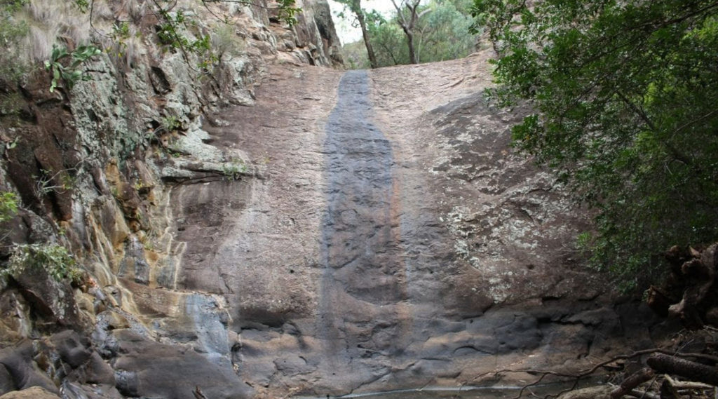
Out of nowhere a Racecourse appears, then shortly after that is a turn off to Dripping Rock.
A slight detour, one way in and out.
If the area wasn’t in drought it would be an amazing water hole to relax and escape the heat.
But this time there was barely any water and it smelt like goat pee, but still worth the drive to take a look.
NEXT STOP – SAWN ROCKS
While I was based in Narrabri for work for the next 6 days.
So I looked up what else was within reach to explore in the afternoons.
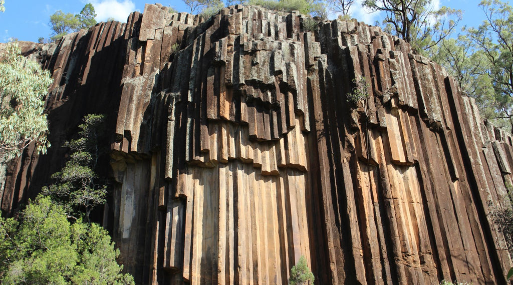
One spot I had driven past numerous times but never turned off was Sawn Rocks.
Swan Rocks was about 36 km out of Narrabri on Killarney Gap Road, an impressive pentagonal basalt.
A HUGE Pipe Organ like structure which just blew my mind!
Sawn Rocks is within Mount Kaputar National Park.
From the carpark it’s about a 15 minute walk in and it has a pretty good path.
This rock formation comes from the slow, even cooling of molten rock that enabled individual crystals within the rock to align perfectly with each other.
A QUICK 58 KM ONE WAY TRIP
The next afternoon adventure was a quick 58 km one-way trip to Waa Gorge on the road to Terry Hie Hie.
A bit of a drive along a very dusty road.
Waa Gorge appeared in the distance, with numerous gates to go through.
This one-man adventure involved more in and out action than the horizontal folk dance with the missus!
With the info sign saying a 1hr walk to Waa Gorge, I had my doubts, but hey let’s go explore.
You first come across the Mill - Bullah waterholes that weren’t as deep as you’d expect due to the drought in this area.
Shame about the drought as the water holes and waterfalls would be spectacular after some rain.
As I hiked up past the plunge pools on this mild 43° day I decided it was best to explore Waa Gorge another day.
Be best when it was a bit cooler and I wasn’t alone for safety reasons.
Time to head back to Narrabri Bowling Club for a few cold frothies.
ARTESIAN BORE BATHS
As another afternoon knockoff approached, Pilliga – Artesian Bore Baths was next on my list.
Having been to Moree and Burren Junction bore baths, I heard that Pilliga was the pic of the bunch and only an hour’s drive from Narrabri.
It was a toasty 43° when I visited.
On reading the information board I found that the bore was sunk in 1902 as part of the town’s permanent water supply.
And even at 38° it felt cool on this hot summer’s day.
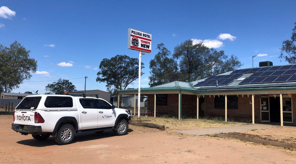
After the bore, I’m onto a couple of schooners at the pub and the purchase of another coldie holder would be the order of the day.
TOUGH BACK THEN
On the way, there’s plenty to see if you really look.
I don’t know why it is but I love looking at old infrastructure, disused railway lines, loading cranes, grain silos.
Just thinking of how tough it was back then and the effort it took to survey, design, build and maintain these services before cars and trucks took over.
Other things spotted along the way were old concrete mile markers, wedge tail eagles, old shearing quarters and plenty of rusty tin.
Arriving at Pilliga having a quick drive around this semi remote town which was established back around 1867.
You can obviously tell that things have slowly changed, but not that much to be honest.
It would have been quite tough living back in those days.
COORDINATES OF MENTIONED LOCATIONS
Racecourse in the middle of nowhere – -30.6810° 150.2361°
Dripping Rock Turn Off – -30.6578° 150.1922°
Dripping Rock – -30.5966° 150.2962°
Sawn Rocks – -30.1453° 150.0540°
Mill-Bullah Waterholes – -30.0634° 150.0998°
Words and Images by Jereme Lindsell of Trickydevil Offroad
WHERE TO FIND JEREME
Instagram: @trickydevil_offroad
Youtube: Trickydevil Offroad
Facebook: Trickydevil Offroad